Mobile LiDAR · roads
Point cloud classification. Online, from €10 per hectare.
Upload your LAS or LAZ files, pay by card, download the LAZ classified point by point. €10 per hectare if your point clouds may be used to train our models, €15 otherwise. For professionals only.
- Input
- LAS / LAZ
- Output
- LAZ · LAS 1.4
- Minimum
- 0.5 ha
- Indicative turnaround
- 2 working days
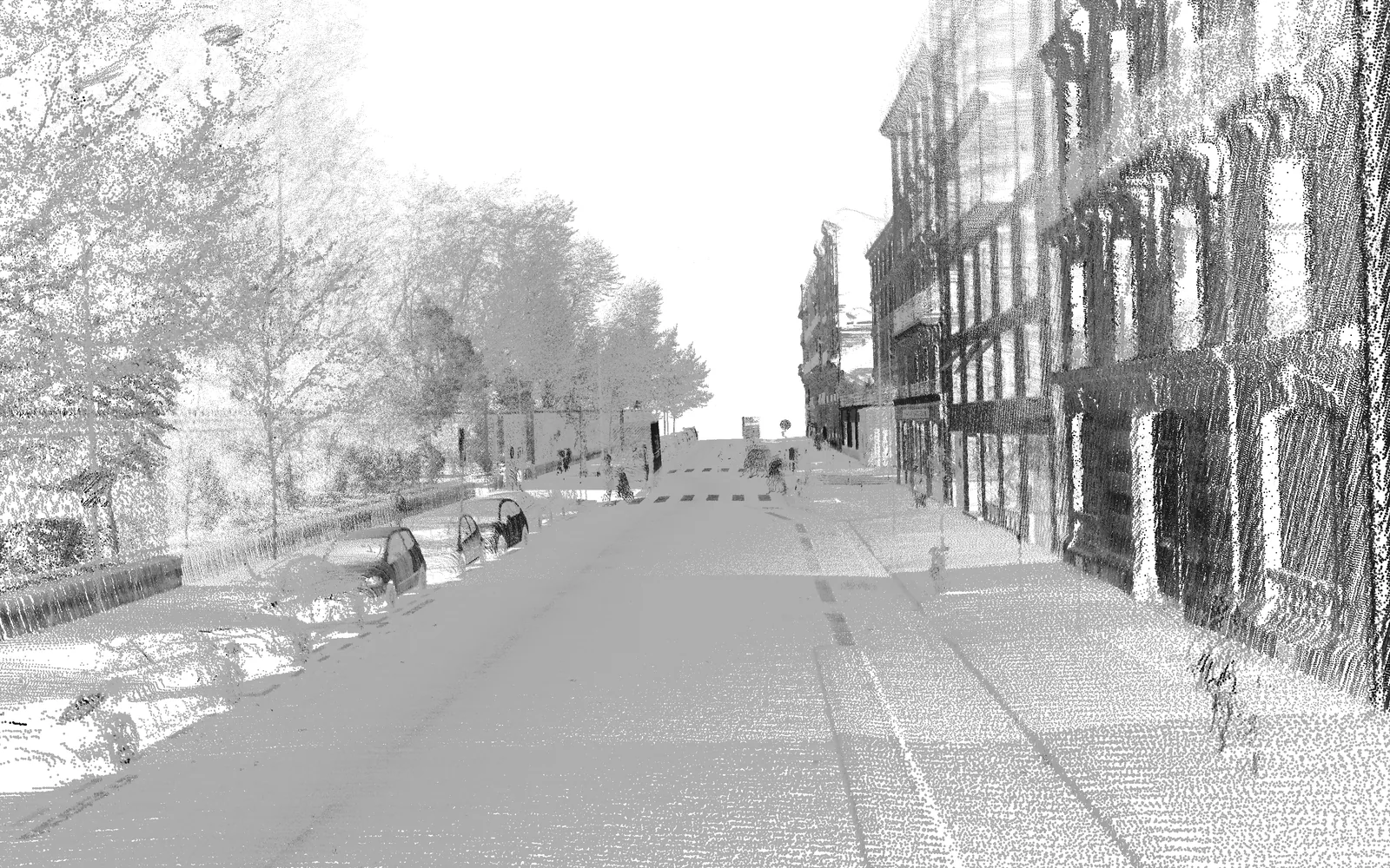
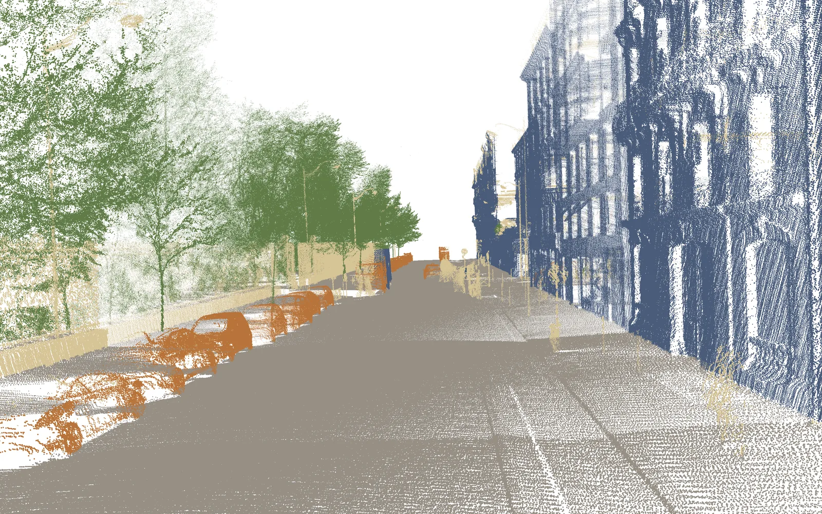
- Ground
2 - Vegetation
5 - Building
6 - Vehicle
65 - Unclassified
1
Services
Classification is ordered and paid for online. Automatic DXF drawing is in development: sign up to be told when it opens.
MLS point cloud classification
€10
per hectare of footprint, with use for training
€15 without this use
VAT not applicable, art. 293 B of the French Tax Code (CGI)
LAS or LAZ files, as they come out of trajectory processing.LAZ, with a class and a confidence score for each point.- Ground
2 - Vegetation
5 - Building
6 - Vehicle
65 - Unclassified
1
Price examples
Exact price shown before payment. First order: the first 0.5 ha is deducted.
Automatic DXF drawing
A first vector drawing traced from the point cloud alone, with no existing plan. Your technician reviews and corrects it in their own software.
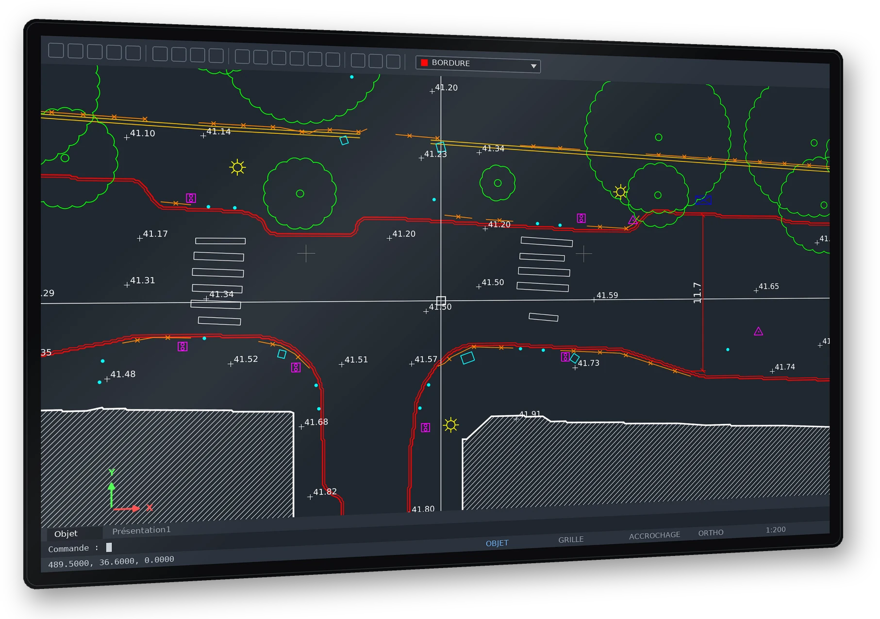
BORDURE FACADE MARQUAGE ARBRE ECLAIRAGE SIGNALISATION MOBILIER CLOTURE ALTI COTATION
Example of the target output, drawn from the Paris-Lille-3D research dataset (MINES ParisTech).
LAS / LAZ point cloud, and your layer standard if you have one.DXF: polylines and blocks, one layer per object type. Uncertain objects go on a separate layer to check.How to order
Your account is created with your email address: a sign-in code is sent to you, no password needed.
- 01
Upload
Drop in your LAS or LAZ files. The coordinate reference system is read from the headers, or chosen from a list.
- 02
See the price
The footprint is measured on a 1 m grid. The exact price is shown before any payment.
- 03
Pay
By card on the Stripe payment page. The invoice is issued with the order.
- 04
Download
An email lets you know. The classified LAZ files and the report stay in your customer area for 30 days.
Specifications
Classification: what goes in, what comes out. Uncertain points stay unclassified; no class is forced.
LAS 1.2 to 1.4 or LAZ files. Fields used: x, y, z, intensity, GPS time.LAZ, LAS 1.4 format, point format 7. Same points, same coordinates, same coordinate reference system.- Ground
2 - Vegetation
5 - Building
6 - Vehicle
65 - Unclassified
1
confiance (confidence) field from 0 to 1 for each point. Below 0.6, the point stays in class 1.Your data
You can allow your point clouds to be used to train our models, including DXF drawing. It is optional: a choice in your account, with no default answer, which you can change at any time. With your permission, a hectare costs €10; without it, €15.
- What we do
- If you allow it, we annotate objects by hand in your point clouds (kerbs, manholes, poles…) to train our models. Otherwise, your point clouds are used only for your order.
- What we don’t do
- We do not resell your point clouds, publish them or show them on this site.
- Where
- Processing and storage in the European Union (Sweden).
- How long
- Your files can be downloaded for 30 days. The training copy is kept for as long as it is used to develop our models and reviewed every 3 years; you can withdraw it at any time.
Frequently asked questions
For anything else, write to contact@geodalia.com.
We lay a 1 m grid over your points seen from above. Each cell containing at least one point counts as 1 m². A street 1 km long and 25 m wide is about 2.5 ha, i.e. €25 (€37.50 without use for training).
€10 per hectare if you allow your point clouds to be used to train our models, €15 otherwise. You choose in your account when you first sign in, with no default answer; you can change your choice at any time. No resale, no publication; you can withdraw at any time.
Companies and public bodies, for professional use. The SIREN (French company number) is asked for when you first sign in; outside France, your company’s identifier in its own country.
Your first order is free up to 0.5 ha. Above that, the first 0.5 ha is deducted from the price.
Up to 20 GB per file and 100 GB per order.
It is read from the LAS headers. If it is missing, you choose it from a list before paying.
An invoice in French, issued with the order and sent by email, showing your SIREN and your purchase order number. VAT not applicable, art. 293 B of the French Tax Code (CGI).
Send your purchase order to contact@geodalia.com. We process the order, and you pay by bank transfer after delivery, against an invoice submitted on Chorus Pro.
Report the defect within 14 days of delivery. If it comes from the service, we run the processing again; if it persists, we refund the order.
30 days in your customer area after delivery.
In the European Union, in Sweden: processing and storage.
No date has been announced. Sign up in the DXF drawing section to be notified.